
Bossier City ZIP Coverage
Six ZIP labels are associated with Bossier City in the inspected USPS material. They do not divide the city into neat civic districts. One has a distinct Barksdale Air Force Base context, one is the familiar core street-delivery code, and others need a full-address check because the official sources did not publish exact neighborhood or station boundaries. The table keeps those gaps visible.
| ZIP Code | Areas Covered | Post Office | Notes |
|---|---|---|---|
| 71110 | Barksdale Air Force Base context | Barksdale-related operation | Federal-installation label; station not located |
| 71111 | Core Bossier City street delivery | Bossier City delivery area | City and ZIP polygons still differ |
| 71112 | Bossier City delivery addresses | Exact station not located | Official neighborhood split not published |
| 71113 | Bossier City USPS label group | Exact assignment not located | Verify the complete address |
| 71171 | Bossier City mailing and PO boxes | Bossier City PO-box operation | A box does not locate a parcel |
| 71172 | Bossier City label or PO-box group | Exact assignment not located | Service profile needs USPS lookup |
The Louisiana State Library list separates nearby parish communities: Benton uses 71006, Elm Grove and McDade use 71051, Haughton, Princeton and Red Chute use 71067, and Plain Dealing uses 71064. Those are Bossier Parish places, not extra Bossier City ZIP codes. For any live mailing question, the USPS address result is the final postal check.
Verify Bossier City Postal Codes
The USPS ZIP Code Lookup supports three useful checks: enter a complete address, find ZIPs for a city and state, or identify cities associated with a ZIP. The full-address mode is best when a street number and unit are known. A city-wide result can show valid labels, but it cannot decide whether the parcel lies within Bossier City's legal boundary.
The official lookup screen is the source for Bossier City's postal verification step.
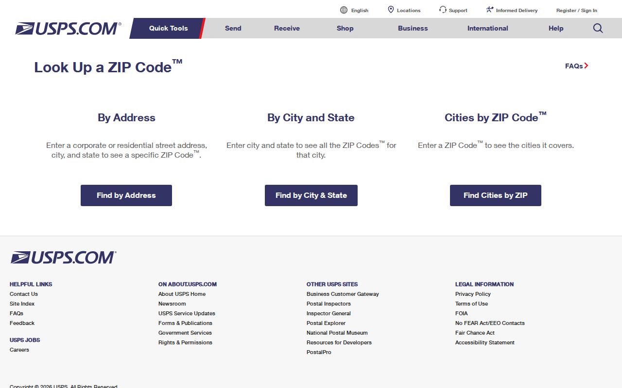
Use the returned ZIP and ZIP+4 as mailing data, then move to GIS for the municipal and parcel questions.
Bossier City 71111 Address Core
ZIP 71111 is the most familiar core Bossier City street-delivery code. City Hall at 620 Benton Road and municipal addresses along Old Shed Road use it. That makes 71111 a strong search term when a record already names a city office or core street, but it still does not supply a roster of residents or an incorporated-city polygon.
Old Bossier, Bossier Annex, the East Bank, Airline Drive and the I-20 corridor are useful place terms in local sources. They should not be assigned wholesale to 71111 without a specific USPS result. A neighborhood name, subdivision, postal code and city boundary can all describe different shapes.
Note: Store the full street and unit with 71111; a ZIP alone cannot distinguish one Bossier City household from another.
Bossier City ZIP 71110 Context
ZIP 71110 carries the Barksdale Air Force Base context under a Bossier City postal label. The installation sits beside the city and has its own federal setting. That label is not proof that an address belongs to the incorporated city, nor does a past base link prove a current Bossier City home.
Barksdale's construction in 1930 and dedication in 1933 made the installation a lasting part of local records. A surname may appear in a Shreveport/Bossier directory, a base-related newspaper item, a business filing and a parcel record. Keep the agency and date attached to each result. Bossier's postal directory treats 71110 as a special context, not as an ordinary neighborhood bucket.
Check Four Bossier City ZIPs
Addresses using 71112, 71113, 71171 and 71172 need complete-address verification. The inspected official sources grouped each with Bossier City, yet did not publish a reliable station assignment or neighborhood split for all four. ZIP 71171 has a documented mailing and PO-box role, including a city box address. A PO box tells where mail is received, not where a parcel or person is located.
No official Bossier ZIP split, realignment or boundary-change timeline was found. That gap matters. Do not invent a year or assume that an old directory's code maps to today's service area. Check the source date, use USPS for current delivery, and keep old printed postal data exactly as shown when doing family or address history.
Find Residents by Bossier City ZIP
A ZIP can narrow a name or record search, but each portal reads it differently. SmartCAMA's Mailing Zip field filters tax correspondence addresses. The voter portal uses ZIP with a person's name or a full street address. The Louisiana Real Estate Commission treats ZIP as one license-search field. None of those searches creates a complete list of everyone physically present in the postal area.
- Normalize the street, suffix and unit. Verify the mailing code with USPS.
- Check the Bossier Parish GIS parcel and municipality. Save the parcel or assessment identifier.
- Compare SmartCAMA's physical address with its mailing city and Mailing Zip. Do not merge those fields.
- Use ZIP as a required matching input in the voter portal or as a license filter only when that source answers the question.
- Move to a by-address search after the ZIP has narrowed the area. The Bossier City street directory follows that finer record trail.
Preserve negative results with care. A person may own a Bossier City parcel while receiving tax mail in another ZIP. A voter search may fail because one required birth field is wrong. A GIS layer may show the municipality but not expose a ZIP field at all.
Bossier City ZIP Search Fields
The ZIP-capable portals do not share one meaning. Read the field label before drawing a resident conclusion. SmartCAMA is the most important trap because its advanced field is explicitly Mailing Zip, not physical parcel ZIP.
| Official search | ZIP-related field | Required | What the match means |
|---|---|---|---|
| SmartCAMA | Mailing Zip | No | Assessment mail goes to that ZIP |
| Voter name form | ZIP with first/last and birth month/year | Yes | Matches a known registration |
| Voter address form | ZIP, street, unit and city | Yes | Matches the entered address |
| LREC license search | ZIP among license fields | One field required | Narrows public license records |
| USPS lookup | Address, city/state or ZIP | Mode dependent | Confirms postal assignment |
The Sheriff tax portal can search by bill number, parcel number, taxpayer name or address, but no ZIP field was exposed. The Secretary of State commercial search also lacks an inspected ZIP mode. Use the fields actually present instead of forcing a ZIP workflow onto every record.
Bossier City ZIP Parcel Layers
A sound Bossier City postal search keeps three address forms apart. The physical or situs address marks the parcel's street location. The mailing address receives assessment or tax mail and may belong to an owner, trust, agent or lender elsewhere. The deed's legal description identifies land through subdivision, lot, block or another formal description.
The parish GIS adds roads, parcels, sections, municipal boundaries and aerial context. Its data are not a legal survey. Use the map to orient the search, SmartCAMA to read the assessment, and the Clerk's recorded document when a legal land fact matters. This flow survives spelling differences better than a ZIP-only match.
Record flow: full address → USPS ZIP → GIS municipality and parcel → SmartCAMA physical and mailing fields → Clerk legal description.
Separate Bossier City ZIP Neighbors
Bossier Parish is broader than Bossier City. Benton is the parish seat north of the city. Haughton, Princeton, Red Chute, Elm Grove, McDade and Plain Dealing carry other postal labels. Across the Red River, Shreveport supplies a separate city context even when a historical directory or regional record covers both sides.
This geography changes where records are kept. The Assessor, Clerk and 26th JDC work at parish scale. Bossier City Court and city permits use municipal jurisdiction. USPS handles delivery labels. Barksdale adds federal-installation context. A Bossier City ZIP code narrows postal routing, while the custodian's jurisdiction determines which office can answer the record question.
Boundary check. Never infer a Bossier City resident or city jurisdiction from a postal label alone; verify the parcel and municipality.
Bossier City ZIPs Versus Limits
Postal routes and city limits solve different problems. Barksdale and unincorporated parish addresses can use a Bossier City label. A city-oriented route can also extend beyond the incorporated boundary. The mismatch is expected, not a data error. Use the GIS municipality layer and parcel identifiers for civic location, then use USPS for delivery.
The Bossier City ZIP code directory cannot show who occupies a home. It also cannot turn a mailing ZIP into a parcel count, voter total, or legal boundary. Those questions need their own official records and access rules. ZIP-based searches should support family history, civic research, property curiosity or a known-person check without exposing protected addresses or guessing from a broad area.
- ZIP and ZIP+4
- A ZIP marks a delivery area; the added four digits narrow the delivery point or group.
- PO-box ZIP
- A code used chiefly for boxes at a postal operation, not for parcel location.
- Unique ZIP
- A code assigned for a large organization or special delivery context, such as a federal installation.
- Carrier route
- The smaller delivery path used to sort mail inside a ZIP.