
Walk a Bossier City Street
Start with the exact house number, street suffix, unit or lot, and ZIP as printed on the most reliable recent source. The strongest Bossier City street directory chain is address to assessment parcel, parcel to map, legal description to deed index, and then dated evidence about occupants. Ownership and occupancy are separate questions. The Bossier Parish Assessor can identify the assessed owner, while a voter result or printed directory may place a named person at an address on a certain date.
- Enter the physical address in the Bossier Parish SmartCAMA search. Copy the assessment number, owner name, physical address, and legal description.
- Open the public GIS and find the same parcel. Check nearby lots, roads, municipality boundaries, and the map layer date.
- Use the Louisiana Voter Portal address form for a precise address match. Treat a nonmatch cautiously and never infer unlisted household members.
- Carry the owner and legal description to the Bossier Parish Clerk. Search or request the deed that names the prior grantor.
- For an older household, use a reverse or criss-cross directory, then confirm the entry with a census, newspaper, or succession file.
This route turns one street number into a set of dated records. Save the source agency and identifier at every step because the assessor, GIS, Clerk, voter system, and city permit office use different keys.
Search Bossier City Parcels
SmartCAMA offers far more than a single address box. Its advanced fields let a street researcher recover a parcel when the spelling is uncertain or when a subdivision is better known than the road. No field is marked as mandatory in the inspected form. Begin narrowly, then add a lot, block, subdivision, or legal-description term if the first search misses.
| SmartCAMA field | Input | Best street use |
|---|---|---|
| Physical Address | Text | Find the situs, the place where the parcel sits |
| Last Or Business / First | Text | Check owner-name variants |
| Assessment # / Mapping Number | Text | Open one exact parcel record |
| Subdivision / Lot / Block | Text or selector | Bridge a street address to its plat |
| Legal Description | Text | Match the parcel to deeds |
| Mailing Address / City / ZIP | Text | Compare the tax-mail destination |
| Roll / Homestead Status | Selector | Filter assessment records, not occupants |
A selected card can show ownership fractions, homestead fractions, roll and year, assessed values, fees, physical address, location code, and legal description. It also offers map, report, and print actions. The earliest online year is not stated, so do not assume the prior-year selector reaches the start of Bossier Parish records.
Map Bossier City By Street
The Bossier Parish Public GIS viewer adds the street-wide view that a parcel card lacks. Turn on parcels, streets, roads, and municipal boundaries. Aerial photography, including current or 2024 imagery where available, helps orient the search. Sections, planning areas, and parish boundaries help explain why a Bossier City mailing label may not match the legal municipality.
Pan along the named street and click parcels one at a time. Record feature data and parcel identifiers, then open each assessment record. Measure and drawing tools can show rough distance or adjacency, but the GIS expressly says its data are provided as-is and are not a legal survey. Use the Clerk's plat and legal description for a boundary question.
The public GIS page shown below is the source for the parcel-and-street workflow.
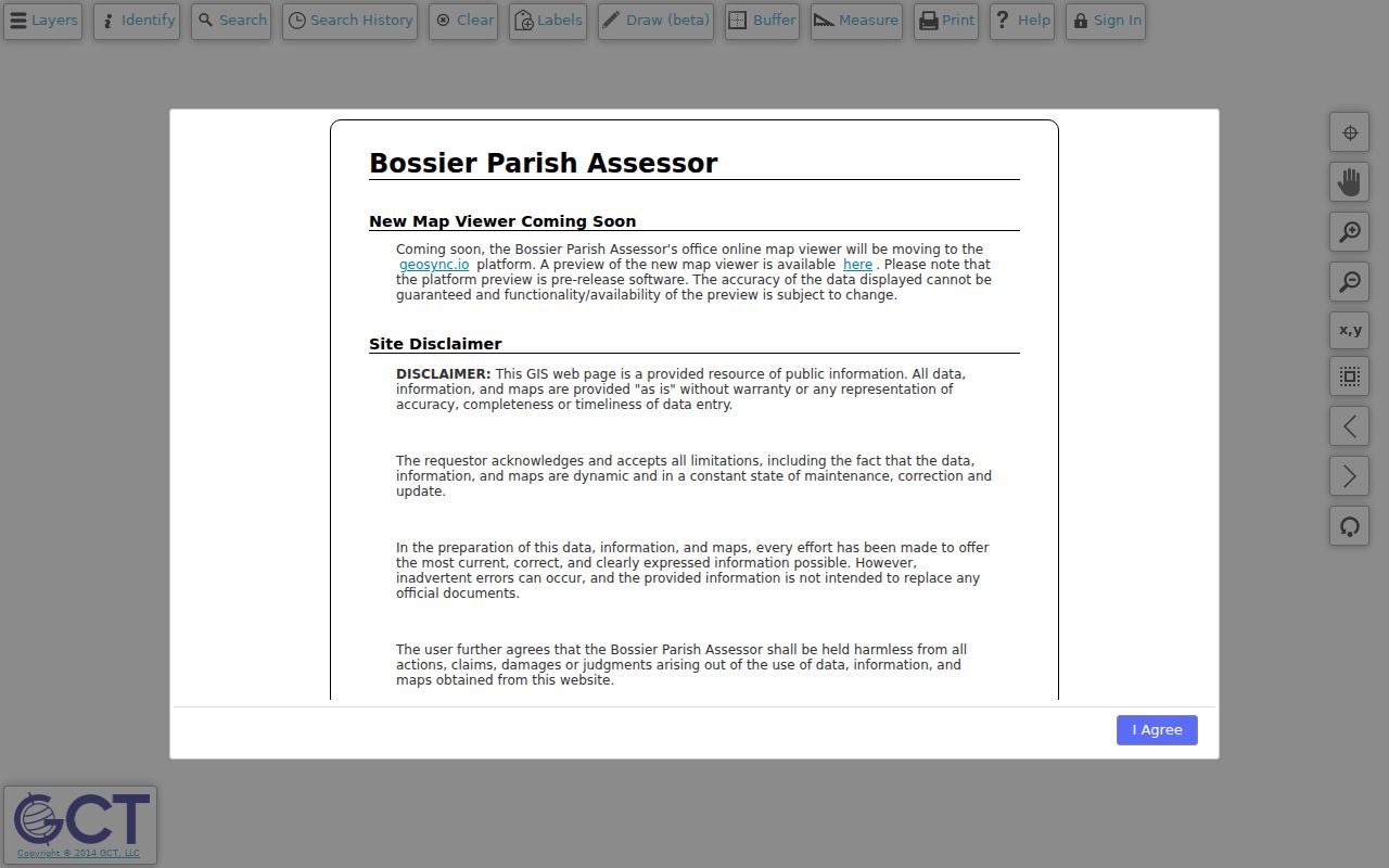
The map is most useful as a bridge from one known parcel to the lots beside it, not as proof of title or household membership.
Note: Preserve the map date and layer names because aerials and parcel data can change after a sale, split, annexation, or new survey.
Bossier City Address Terms
The address search depends on four terms that look similar but answer different questions. Keeping them separate prevents the most common address mistakes in Bossier City.
- Parcel
- A mapped unit of land tied to an assessment number. It may hold one building, many units, or no occupied building.
- Situs address
- The physical location of the parcel. It differs from the address where tax mail is sent.
- Plat
- A recorded map that identifies subdivision lots, blocks, streets, and dedications. The Clerk record controls over a web map.
- Criss-cross directory
- A printed directory arranged by street and house number, used to turn an older address into a named householder entry.
SmartCAMA's mailing ZIP filter searches correspondence destinations. It does not return every physical parcel in that ZIP. A trust, business, agent, or out-of-state owner may receive the bill, and the parcel may still sit on a Bossier City street. Even homestead status is only an assessment clue consistent with owner occupancy, not a roster of people in the home.
Bossier City Street Record Sources
No single Bossier City street directory contains each owner, voter, permit, and former occupant. These official and library sources overlap, but each has its own date and limit.
| Address source | Custodian | What it can show | Route |
|---|---|---|---|
| Assessment card | Bossier Parish Assessor | Owner, mailing and situs fields, values, legal description | Free SmartCAMA search |
| Parcel map | Parish GIS cooperative | Lots, roads, sections, municipalities, aerial context | Free public viewer |
| Deeds and plats | Bossier Parish Clerk | Transfers, parties, registry data, legal description | Clerk Connect or Benton office |
| Tax account | Bossier Parish Sheriff | Taxpayer, parcel, notice, address, year, balance | Online tax portal |
| Voter match | Louisiana Secretary of State | Voters matched to entered address, subject to protections | Address form or Registrar |
| Permit or code file | Bossier City | Job address, owner or builder, work or violation event | EnerGov or records request |
| Printed directory | Bossier History Center | Dated householder, address, phone, and work clues | Catalog, staff request, or shelf |
The assessment number links SmartCAMA to the map. The legal description links that parcel to the recorder. A street spelling links the same place to permits, voter matches, and printed directories, but none of those later sources replaces the deed.
Trace Bossier City Street Deeds
The Bossier Parish Clerk of Court records conveyances, mortgages, liens, releases, and plats. Clerk Connect lists Bossier land-record inquiries, although a subscription may be needed to search or print. The landing page does not publish Bossier's online cutoff, image span, exact fields, or fees. Older books and certified copies may require a request or a visit to the Clerk at 204 Burt Boulevard in Benton.
Start with the current owner as grantee, meaning the person or entity receiving property. Find the newest purchase deed and copy its grantor, the person or entity transferring it, along with the instrument or registry number and legal description. Search that grantor as an earlier grantee. Repeat while the legal description stays consistent. If a trust, company, or succession appears, follow that named entity rather than assuming it was an occupant.
The state's microfilm list shows “None” for Bossier, but that is not proof the old books vanished. The Clerk retains custody, and the list says permission is needed before using parish records at the State Archives. A street search must preserve that gap instead of inventing online years.
Check Bossier City Tax Accounts
The Sheriff's property-tax system is separate from SmartCAMA. Its visible search choices are notice or bill number, parcel number, taxpayer name, or address, with a tax-year selector. Search tips favor a surname or first business word, or the street number plus the first street word. A bill confirms an annual tax account, not everyone who used the address.
The Bossier Sheriff tax portal shown below gives the street directory a second current address check after the assessor.
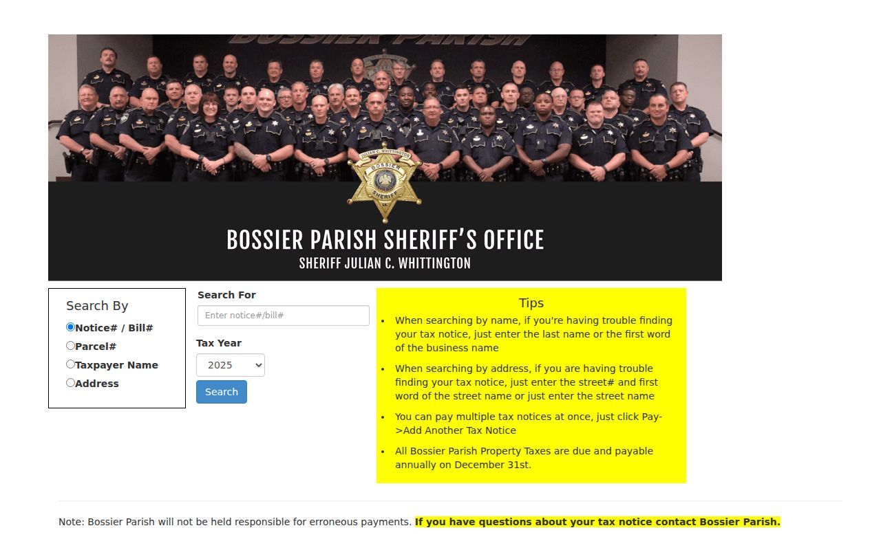
Match the parcel number and tax year back to SmartCAMA. The portal's earliest year was not located, so a missing old bill calls for the Sheriff or Clerk, not a guess.
Bossier City Permits By Address
The Bossier City Permits and Inspections Division handles building, electrical, plumbing, and mechanical work. The public application includes job location, subdivision, unit, lot, owner and phone, architect or engineer, builder, work type, square feet, remarks, and permit number. EnerGov displays Apply, Today's Inspections, Map, and Search routes, though registration is required for many actions and the historical online span is not stated.
Property Standards keeps a second kind of address file for conditions such as high weeds, litter, inoperative vehicles, and nuisances. Complaints need an exact location and may be anonymous. A code file can date a notice or action on a parcel, but it is not a dependable owner or occupant directory. When the portal does not expose the needed year, request the exact job address, record type, and date range from the city custodian.
Read Older Bossier City Streets
A reverse directory turns a house number into a historical householder. The Bossier Parish Libraries catalog lists 95 Polk Shreveport/Bossier City items, but it does not publish a year-by-year run. The History Center can confirm the shelf and missing years. For the full collection and entry method, use the Bossier City city directory resource.
One supplemental 1935 to 1941 transcription shows McDada and McDade spellings and changing numbers for the same Gowan trail. That quirk is a warning, not proof of a formal renumbering. No official citywide street-renaming or renumbering timeline was found. Search all printed variants, then bridge them with subdivision, lot, block, or legal description before deciding that two entries describe different places.
Bossier's geography adds more labels. A postal address may point toward Barksdale Air Force Base, an unincorporated parish pocket, or a Bossier City route, while the courthouse remains in Benton and Shreveport sits across the Red River. Save the source date and jurisdiction with each result.
Note: A neighborhood name such as Old Bossier or Shady Grove is a useful search term, but it is not a legal subdivision boundary.
Limits of Bossier Street Records
Address records can document ownership, a tax account, a registered voter match, a permit event, or a dated printed householder. They cannot reliably identify every person living behind a door. Renters and other household members may not appear in a public address-keyed record. Utility customer data and motor-vehicle addresses are not open resident rolls. Sealed, juvenile, adoption, and protected voter records remain unavailable.
The Louisiana Address Confidentiality Program protects the physical address and related voter information of qualifying participants. Law-enforcement address protections also apply under voter law. Never try to defeat those safeguards. A voter nonmatch means only that the entered fields did not return a record.
Lawful use. Use Bossier City address records for personal research, family history, property questions, and civic understanding. Never use them to stalk, harass, threaten, or harm anyone.
For a modern one-name question, the Bossier City resident lookup follows a different verification path. Keep a street-wide search focused on parcels and dated address evidence.