
Bossier City Neighbors by Source
A block lookup joins several public sources because each answers a different question. The parcel map shows which lots are next to the target. The assessment roll names owners and separates the physical address from the tax-mail address. Land records show legal transfers. Voter, permit, covenant, and meeting records add limited public facts. None is a complete roster of Bossier City neighbors.
| Source | What It Shows About a Block | Access |
|---|---|---|
| Bossier Public GIS | Lots, roads, adjacent parcels, sections and municipal context | Public map; not a legal survey |
| SmartCAMA | Assessment owner, situs, mailing address, legal description | Public, parcel by parcel |
| Clerk land records | Transfers, plats, liens and legal descriptions | Clerk Connect or Benton counter |
| Louisiana Voter Portal | Limited result for an entered address | Official form; statutory limits apply |
| City records | Permit, code, covenant, board and meeting facts | Portal, document page, or request |
| Library collections | Past occupants and local context | Catalog, databases, or staff request |
An owner's name is not proof of who lives on a lot. A mailing address can belong to an owner, agent, trust, or out-of-area contact. Use “owner shown on the assessment” instead of calling that person an occupant. That one wording choice prevents most false claims about neighbors.
Open the Bossier Neighbors Map
The current Bossier GIS viewer is the spatial starting point. Turn on parcels, streets, and aerial imagery, then zoom until the target and adjoining lots are distinct. The viewer also supplies roads, sections, parish and municipality context, and planning-area layers. Its data are provided as-is and are not a survey or final proof of a boundary.
The current viewer gives a clear visual path into Bossier City neighbors research.
Record the layer date and parcel identifier before leaving the map. Those details let SmartCAMA and the Clerk confirm what the screen only sketches.
Map Bossier City Neighbor Parcels
Work outward one lot at a time. Parcel selection is more accurate than drawing a freehand circle when the aim is to identify the lots that actually touch the target. The GIS measure tools are useful for context, but they do not replace a survey or a Clerk plat.
- Locate the known address and confirm its parcel shape.
- Click each parcel that shares an edge, recording feature data and map identifiers.
- Open each parcel in SmartCAMA. Copy the owner, physical address, legal description, and assessment number.
- Use the Clerk only when a transfer, plat, or old ownership chain is needed.
SmartCAMA also shows ownership fractions and homestead fractions, but those fields do not name every resident. When the question expands beyond the immediate block, the Bossier City street directory carries the full street-by-street method.
Check Bossier Neighbors in SmartCAMA
Search SmartCAMA with the parcel mapping number or assessment number taken from GIS. Physical Address is the situs, meaning the place where the parcel sits. Mailing Address is the destination for assessment mail. Legal Description, Lot, Block, Subdivision, Roll, Neighborhood, and owner-name fields help test whether the right parcel was opened.
| Field | Use on the Block |
|---|---|
| Assessment number | Stable link to the assessment card |
| Physical address | Matches the mapped parcel |
| Mailing address | Contact destination, not occupancy proof |
| Legal description | Connects lot, deed and plat |
| Ownership fraction | Shows a divided interest, not household size |
Compare identifiers, not just names. Two Bossier City owners can share a surname, and one owner can hold several lots.
Bossier Neighbors and Voter Limits
The Louisiana Voter Portal has a search-by-address route, but the voter file is controlled by Louisiana Revised Statutes 18:154. Protected participants in the Address Confidentiality Program do not have ordinary public address exposure. A returned record relates to the entered address and voter status; it does not establish all people in a home.
Do not infer an unlisted adult, child, renter, or family tie from a result. Registration can lag a move, and nonappearance has many lawful causes. Use the portal for its stated election purpose and keep block notes to the fields the official result actually shows.
Bossier Neighborhood Covenant Records
The city's Neighborhood Covenants page publishes subdivision documents for places including Bellaire, Bens Place, Cypress Place, Shady Grove, and Savannah Place. These files can identify recorded restrictions and the subdivision name tied to a block. They are not member rolls and do not promise current officer contacts.
| Named Area | Official Resource | What to Expect |
|---|---|---|
| Bellaire | City covenant page | Subdivision covenant document |
| Bens Place | City covenant page | Recorded restrictions, not household contacts |
| Cypress Place | City covenant page | Subdivision context |
| Shady Grove | City covenant page | Covenant access |
| Savannah Place | City covenant page | Covenant access |
No official umbrella Bossier City association directory or private roster was located. Contact claims should be checked against the city, a recorded filing, or an organization itself.
Bossier Neighbors in Civic Records
Neighborhood life can also surface in public meetings, boards, parks, and city plans. The Bossier City CivicWeb portal holds agendas, minutes, reports, and board or commission material. It may name officials, appointees, or people who took part in a public proceeding. It is not a block roster.
The portal image helps distinguish public civic participation from private neighbor data.
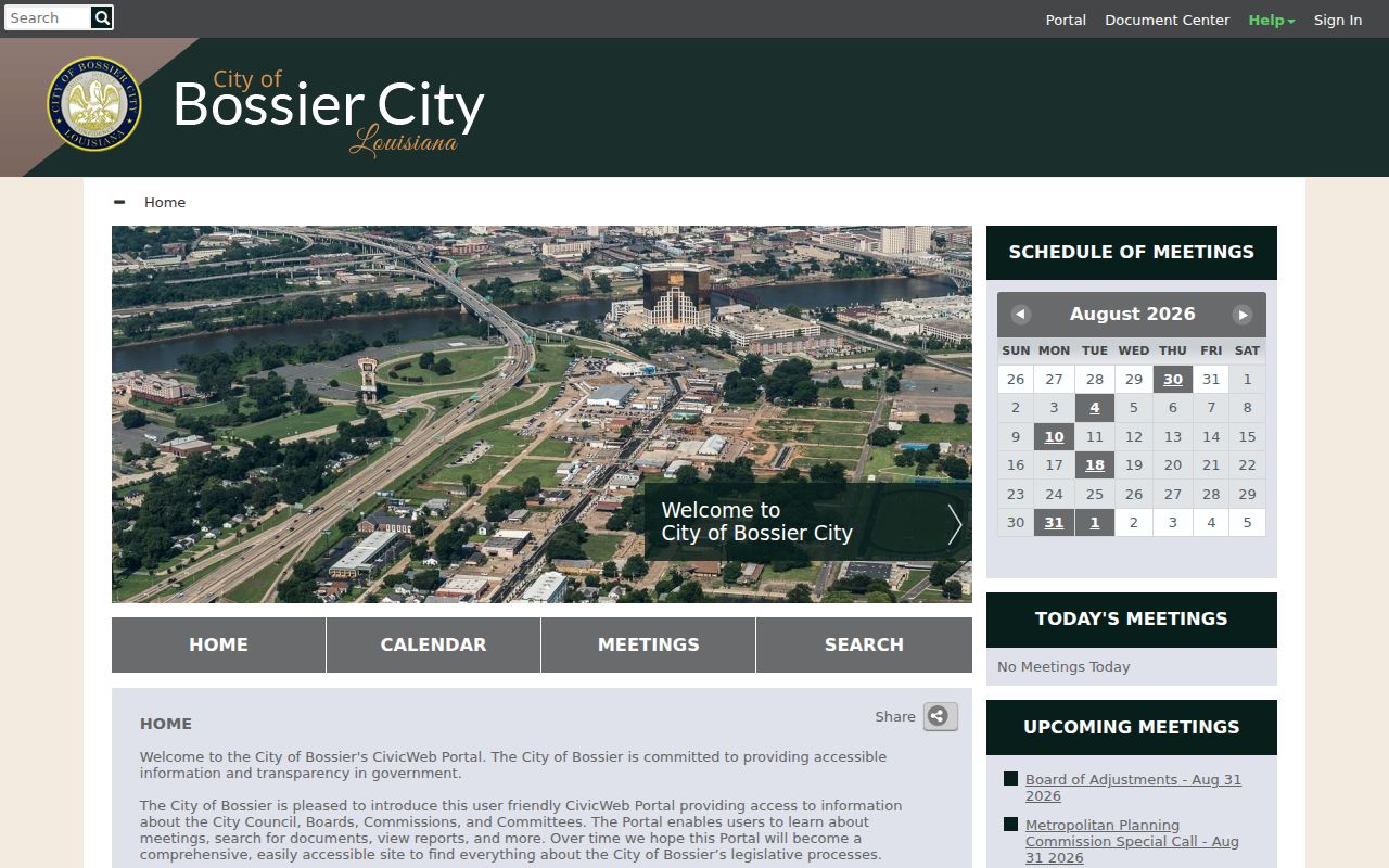
Search a subdivision or street term in dated meeting material, then cite the document and meeting date rather than turning a public appearance into a broader claim.
Bossier City Neighbor Labels
City sources use names such as Old Bossier, Bossier Annex, Barksdale Annex, Shady Grove, Sun City, Stockwell Place Estates, Savannah Place, Stonebridge, Carriage Oaks, and Brookhaven Estates. These names help find city documents, but they are not all legal plats or fixed boundaries.
A Bossier City postal label also does not prove that a parcel lies inside the incorporated city. Benton is the parish seat, Shreveport sits across the Red River, and Barksdale has its own postal setting. Confirm the municipality layer in GIS before describing a block as city territory.
The street-to-neighborhood PDF is useful for matching a road to a current service label. Pair it with the GIS municipality and parcel layers. If the names disagree, record both and state which agency used each one. A neighborhood name can guide a covenant or meeting search, while the legal description controls the parcel link.
Official Bossier Neighbor Records
Official records are narrower than commercial neighbor tools, but their custody, dates, and defined fields make them easier to verify. Commercial products may merge old addresses, phones, and unnamed sources. They should not replace the parcel or recorded document.
| Choice | Strength | Limit |
|---|---|---|
| GIS and assessor | Official parcel and assessment context | Owner is not always occupant |
| Clerk record | Recorded legal transfer and description | May require counter or subscription access |
| City civic record | Dated public event or document | Not a household list |
| Commercial category | May combine broad hints | Source age and accuracy may be unclear |
For personal safety or civic curiosity, keep only what answers the specific block question and verify it with the custodian.
Privacy for Bossier City Neighbors
Public parcel data leaves much of a household private. Renters and other household members may not be named. Utility accounts, motor vehicle addresses, protected voter records, sealed cases, juvenile records, and adoption files are outside an ordinary block lookup. A map of adjacent lots never grants permission to infer who lives inside them.
Louisiana's Address Confidentiality Program can protect eligible address information, and agencies may redact nonpublic fields while releasing a public portion. Respect those limits. If a record appears wrong, seek correction from the office that keeps it rather than spreading the error.
People move, assessment rolls change by year, and a meeting document captures only one public event. Date each result and keep its agency name. When two sources conflict, the parcel identifier and legal description can settle land identity, while only a source about occupancy can support a claim about who lived there.
Lawful use. Learn about a Bossier City block for civic interest, reconnection, or personal safety. Never use public records to watch, threaten, harass, or harm your neighbors.